 DE
DE  EN
EN  NL
NL Imagine the possibilities..
Song-Credits:
"What a Wonderful World," performed by 2WEI,
Ali Christenhusz, and Edda Hayes.
Services
We offer a wide range of GIS services for organizations working with spatial and demographic data. From analysis and automation to visualization and web integration: we make data clear, reliable, and actionable.
GIS Analysis & Spatial Insight
We support the analysis and interpretation of spatial data to clarify complex issues. Smart GIS analyses provide insights that help with informed decisions and more efficient processes.
Applications include:
- Spatial analyses and modeling
- Network and accessibility analyses
- Scenario and impact analyses
- Support for policy and planning issues
Demographic Analyses
Demographic data often forms a crucial layer within spatial challenges. We help analyze, combine, and visualize demographic data in its geographic context.
Examples:
- Population structure and development
- Segmentation and target group analyses
- Combining demographics with infrastructure, networks, or facilities
- Support for location choices and strategic planning
Automation
Your complex workflow can be implemented in a user-friendly tool.
Automation & Data Integration
We develop automated GIS solutions that reduce manual work and make processes reproducible. We also ensure robust connections between different data sources.
Think of:
- GIS workflows and model automation
- Links to databases, Excel files, and external sources
- Processing large and incomplete datasets
- Consistent and repeatable analyses
Visualization & Geographic Animations
Clear visualizations make complex data understandable. We design maps, dashboards, and geographic animations that bring data to life and make it accessible to a wide audience.
Possibilities:
- Custom map visualizations
- Geographic animations (e.g., time series or scenarios)
- Presentation maps and reporting visuals
- Support for communication and decision-making
Our first layer is still the foundation of quality!
Just like stacking these five perfect pancakes, we ensure excellence from start to finish.
Web Maps & Website Integration
We seamlessly integrate interactive maps and spatial data into websites and web applications — for both new websites and existing platforms.
We can assist with:
- Integration of interactive maps on websites
- Implementation of map data in an existing website
- Renewal or redesign of an existing website, including map functionality
- Advice on usability and performance
We can also provide hosting and domain registration so everything is managed under one roof.
GeoServer & GIS Infrastructure
For organizations that want to manage and publish their own data, we set up tailored GIS infrastructure.
Including:
- Setting up and configuring GeoServer environments
- Publishing map layers and services
- Support for GIS data management and structure
- Advice on scalability and future-proofing

Collaboration & Approach
We work as a compact and flexible team and switch quickly. Whether it’s a defined issue or long-term support: we think along, work pragmatically, and deliver solutions that keep working in practice.
Want to know more?
→ Contact us
For an introduction:
→ Schedule an appointment
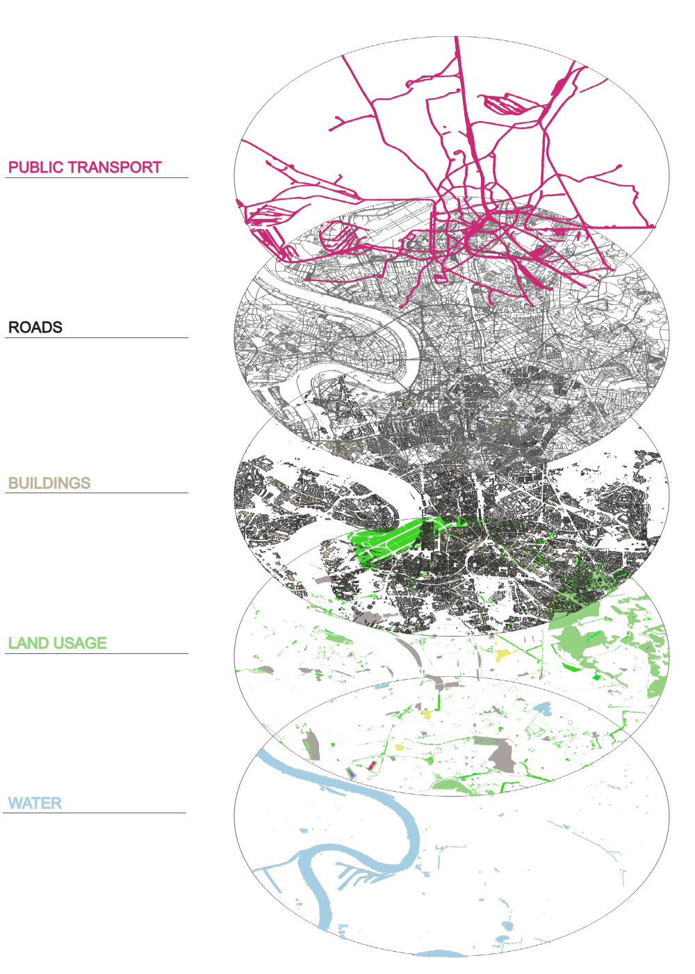
Scope of Work
Our scope is comprehensive — and we don’t just say that for search engines. Anything with a “where?” can be mapped. Even things without a physical location (like networks or influence) can be represented cartographically. Challenge us to find a use case we can’t solve: